What we know so far:
- Category 4 storm made landfall between Bowen and Airlie Beach just after midday
- Downgraded to category 3 about 4pm
- Around 30,000 people told to evacuate along Queensland's north coast
- At least one fatality already attributed to weather conditions
Queensland emergency services and the Bureau of Meteorology say Cyclone Debbie is now beginning to make landfall between Bowen and Airlie Beach.
The storm had moved as slow as 4km/h in heading to the north Queensland coast on Tuesday morning but quickened to 12km/h as the eyewall made landfall.
The exposed mainland town of Airlie Beach is being battered by the cyclone, after blasting the Whitsunday Islands off the north Queensland coast.
Debbie remains a category 4 - the worst cyclone to hit Queensland in six years - and is packing sustained winds near the centre of 175km/h, and gusts of up to 260km/h.
The eye of the storm was passing over Hayman Island at around 11.30am.

Queensland’s state emergency service (SES) has warned that residents in the storm’s path could be waiting until Wednesday for emergency help, as the destructive slow-moving storm keeps the region in lockdown for hours.
North region SES manager Dale Camp said dangerous conditions will hamper any clean-up efforts.
"We have to wait for that wind to die down before we move around, and if it's at night time it makes it very difficult to see things like floodwaters, so they'll probably be waiting until first light tomorrow," he said.
"It's a very slow-moving cyclone, so we're talking anywhere between six and 14 hours until it's completely over in each location. So that puts it well into this evening, and that's the problem, everyone is going to have to stay in their house all day, and then stay there all night as well.”
WATCH: Cyclone Debbie at Airlie Beach
Queensland Police answering triple-zero calls have told of increasingly panicked calls for help from across the region.
One caller said the roof was peeling off an apartment building and another was cowering in a laundry after the roof of a house caved in, police told AAP from the cyclone response centre in Brisbane.
With little phone service and battery power Patty Whipp described the situation in the Airlie Beach 'red zone'.
"I was evacuated from low lying flood zone on Saturday. I've lost almost everything but I'm safe," she told NITV News.
"Where we are at the moment it's almost 200km an hour wind gusts and it has been raining for 3 days. Flash flooding, trees snapping and debris flying everywhere.
"It's frightening and exciting at the same time. Very loud."
Watch: SBS Correspondent reports from Airlie Beach as Cyclone Debbie approaches
At 6am, the Bureau of Meteorology said the eye wall of the cyclone would across the Whitsunday Islands after 9am AEDT. The forecast timed correctly. One of the islands, Hamilton, has recorded gusts of 230 - 260km/h.
Those taking shelter on the island say the wind is so strong brick buildings are vibrating, and the wind sounds like a series of fright trains charging through.
'Like a freight train'
"It's been a noisy night here in Airlie Beach, it's like having a freight train or a waterfall next to your window," said SBS Queensland correspondent Stefan Armbruster.
"The first trees in our street have fallen down and the cyclone hasn't even reached its intensity yet."
Police Commissioner Ian Stewart said the cyclone's very slow march towards the coast meant a very long and dangerous time ahead for people in and around the expected landfall site just to the south of the coastal town of Bowen.
"Overnight it almost stalled. It is sitting over the edge of the land now - the most destructive core area is right over the edge of the land at Proserpine and Airlie Beach, and of course Hamilton Island is well within that destructive zone," he told the Nine network on Tuesday morning.
"The outer rings - so, the 100 kilometre to 125 kilometre wind zone - is sitting squarely over places like Bowen and Mackay on the edges. But as the cyclone moves forward, we are going to see the full force of that cyclone on the very highly populated areas."
WATCH: Understanding cyclone forecast track maps
An emergency alert was issued last night for the city of Mackay, around 400 km south of Townsville, with more than 30,000 residents in low-lying areas warned to evacuate immediately due to fears of dangerous tidal surges.
The surge - which could inundate low-lying homes - is still expected to be significant. At Laguna Keys, south of Airlie Beach, a storm surge of 1.5 metres has already been recorded, as the tide builds toward its peak later this morning.
Premier Annastacia Palaszczuk has also warned of a possible second storm surge later in the day, and said residents in at-risk communities must understand the danger would last for a long time.
"This will not pass during the day. For the next 12 hours, I need families to remain safe, and remain where they are," she told ABC television.
Residents holed up in danger-zone communities including Airlie Beach, Proserpine, Bowen and Sarina say weather conditions are worsening by the hour, with many reports of power cut, trees down, and some structures losing roofing iron.
Watching and waiting
In East Mackay, resident Mattie Crowe lives just four houses away from the coastline where the storm is expected to impact Mackay the hardest.
"We have lost power around 40 minutes ago. The wind and rain is really severe but the gusts are doing the most damage," he told NITV.
"The storm surge tide is due to hit/peak in about 15 minutes and I'm in the flood zone but stayed in my house. I'm feeling calm although this is my first cyclone as I moved here in 2015 from Canberra and was narrowly missed by Cyclone Marcia in the first couple of weeks of living in Queensland.”
Though he is in a two storey house, he fears he will have to relocate upstairs when the tidal surge hits during the cyclone's peak.
"I feel like my house is going to be flooded or the roof will come off but I'm really hoping both don't happen at the same time. To stay safe I'm in the bottom brick lounge room in my home watching movies on my phone and keeping up to date with the Facebook coverage and Mackay warnings."
The police commissioner said it was now time for communities to settle in and wait it out.
"This has a long way to go ... this is such a slow-moving tropical cyclone, it is like a battering ram effect. These winds are going to keep pounding, pounding, pounding," he said.
"I suspect before the day is out, we will see a lot of structural damage in the cyclone's path."
He said flooding was also likely, as the cyclone moved overland and became a rain depression.
The bureau has already warned some areas could see about half a metre of rain associated with the cyclone, and Mr Stewart said inland communities must understand the danger.
"One of the worst cyclone disasters in Queensland history occurred out at Clermont where 60-odd people drowned because of the rain and the flooding effect of a post-cyclone," he said.
Mr Stewart said Debbie was expected to sweep around over Clermont, southwest of Mackay, down through Rockhampton and possibly out over Hervey Bay.
"We hope of course the destructive winds have gone by then and it will simply be a low, but we have got to keep a close eye on where the cyclone is going," he said, adding some cyclones had in the past headed back out to sea, where they reintensified and posed a second threat.
"Who would know. This is a huge system. And none of us can be complacent about it."
Deputy Police Commissioner Stephan Gollschewski said reports of damage were starting to come in, including roof damage at police facilities in the Whitsundays region.
"We're getting some reports already of roofs starting to lift, including at some of our own facilities in the Whitsundays," he told ABC television.
He warned people they'd be holed up for the entire day on Tuesday, and of concerns for significant flooding in inland areas, as the cyclone degenerates into a rain depression.
" ... we're modelling for the worst-case scenario."
Electricity has already been lost in some communities, and heavy rain has been lashing the north Queensland coast since Monday.
Residents of Airlie Beach report they are seeing conditions rapidly deteriorate, with some locals saying roofing iron has already been lost from some structures.
At nearby Proserpine, one resident, Tina, said conditions had become scary.
"It's frightening. The trees are laying over and the wind .... if this is halfway there goodness when it's fully here it's going to be devastating," she told ABC radio.
An AAP reporter at Airlie Beach said the wind continued to increase throughout Monday night, making it difficult for many residents to sleep.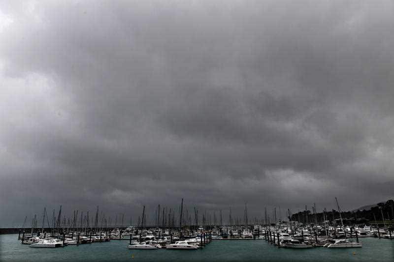 Large gusts with the occasional howling noise were quickly followed by an eerie silence, before the wind started up again a few minutes later.
The weather closes in on Airlie Beach on March 27, 2017. (AAP/Dan Peled) Source: AAP
Alarms at the hotel rang on and off throughout the night, but were gradually drowned out as the wind increased.
WATCH: Graham Buchan at the Ayr Nature Display fears Cyclone Debbie will wipe it out
As well as cyclone damage, authorities are also planning for flooding, which is considered likely as Debbie crosses the coast and degenerates into a rain depression.
Up to half a metre, or 500mm of rain, could fall in some parts of north Queensland.
Major flooding is considered likely in some catchments from as early as Tuesday. Flood watches are in place for for the Ross, Bohle and Black Rivers, Bluewater Creek, Haughton, Lower Burdekin, Don, Proserpine and Pioneer rivers.
As the rain moves across the interior, catchments that could see from flooding form Wednesday include the Fitzroy, upper Burdekin and Belyando, upper Flinders, upper Thomson and upper Barcoo rivers.
Almost 400 schools and child care centres in north Queensland are closed as a result of the Category 4 storm.
Related reading

Palaszczuk warns locals of 'nasty' Debbie

Jan Bridges looks on after advising Police and SES that she will not evacuate her house, situated in a low lying of Ayr, south of Townsville, March 26, 2017. Source: AAP Image/Dan Peled
Townsville residents hunker down
Tahlia Ahoy has told NITV that while it was her first time experiencing something like this, her partner had been through Cyclone Yasi and was making sure their family was prepared.
"The situation at the moment is non stop bad winds and raining on and off," Tahlia Ahoy said.
"My partner and I live in northward which is on the water we had to relocate inland to my partners sisters house yesterday, both our work places are on lockdown until further notice also our daughters day care.
"It's just a waiting game at the moment."
Chris Roberts, an Australian Army rifleman also living in Townsville, said that he wasn't feeling too concerned at the moment.
"[It's] extremely calm compared to what we were originally told would happen - so far," he said.
"Feeling safe and prepared, got bottled water and mostly perishable foods because I don't think the power will go out, and no concerns so far."
Winds continue to pick up in Airlie Beach and likely still have a ways to go as #cycloneDebbie nears pic.twitter.com/yk1CMrK8ok — James Reynolds (@EarthUncutTV) March 27, 2017
WATCH: Understanding tropical cyclone categories